
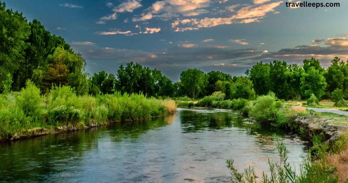
Sometimes you come across a river on a map and wonder why it matters so much to the people living around it. The Vamsadhara River is one of those , not as famous as the Ganga or Godavari, but if you ask folks in Andhra Pradesh or Odisha, they’ll tell you it’s their lifeline. It carries stories of farming, disputes, festivals, and even everyday survival. And honestly, once you start digging into it, you realize it’s more than just a stream of water.
That’s exactly what this post is about. We’ll walk through where the river begins, how it flows, the projects built on it, and even the water-sharing disputes that make headlines. You’ll also find details that help with UPSC prep, local travel insights, and environmental issues tied to the river. By the end, you’ll have a complete picture of why the Vamsadhara matters so much and why people still call it nature’s gift to Andhra Pradesh.
Vamsadhara River Origin
The Vamsadhara River begins its journey in the lush Eastern Ghats, near the Thuamul Rampur area of Kalahandi district in Odisha. Rising at an elevation of about 1,200 meters, it gathers strength from mountain streams before carving its way through valleys and plains. This natural descent makes the river not just a water source but also a scenic marvel for anyone who traces its path.
From its origin, the river flows southward into Andhra Pradesh, eventually meeting the Bay of Bengal at Kalingapatnam in Srikakulam district. Along the way, it nourishes fields, supports wildlife, and becomes an anchor for local communities. The geography of its origin gives it seasonal strength, with heavy monsoon rains turning it into a vital lifeline for both states.
Read must: Do You Know History of Ujjaini Mahakali Temple in Hyderabad?
Vamsadhara River UPSC
For UPSC aspirants, the Vamsadhara River is an important topic under geography, environment, and interstate relations. It often appears in questions related to east-flowing rivers of India, irrigation projects in Andhra Pradesh and Odisha, and water-sharing disputes. Knowing its origin in the Eastern Ghats, its length of about 254 km, and its endpoint at the Bay of Bengal helps build a strong factual base.
Beyond physical geography, UPSC questions may focus on issues like the Vamsadhara River Water Disputes Tribunal, the Neredi and Gotta barrages, and the river’s role in irrigation. Current affairs also matter, especially disputes between Andhra Pradesh and Odisha over water usage. So, preparing this topic gives you both static knowledge and dynamic relevance ,two essentials for the exam.
Visit more: Exploring the Munneru River Key Bridges and Its Importance
Geographic Features of the Vamsadhara River
The Vamsadhara River has several unique geographic features that make it vital for both Andhra Pradesh and Odisha. From its source to its mouth, the river’s journey reflects a mix of natural beauty and practical importance. Here are some of its key characteristics:
Origin and Course
- Rises from the Eastern Ghats near Thuamul Rampur in Kalahandi district, Odisha
- Flows through Rayagada, Gajapati (Odisha), and Srikakulam (Andhra Pradesh)
- Covers a total length of about 254 km before draining into the Bay of Bengal at Kalingapatnam
Basin and Drainage
- Basin area: Around 10,830 sq. km shared between Odisha and Andhra Pradesh
- It is an east-flowing river, similar to the Godavari, Mahanadi, and Nagavali rivers
- Provides fertile alluvial plains, which are crucial for agriculture in Srikakulam district
Climate and Flow
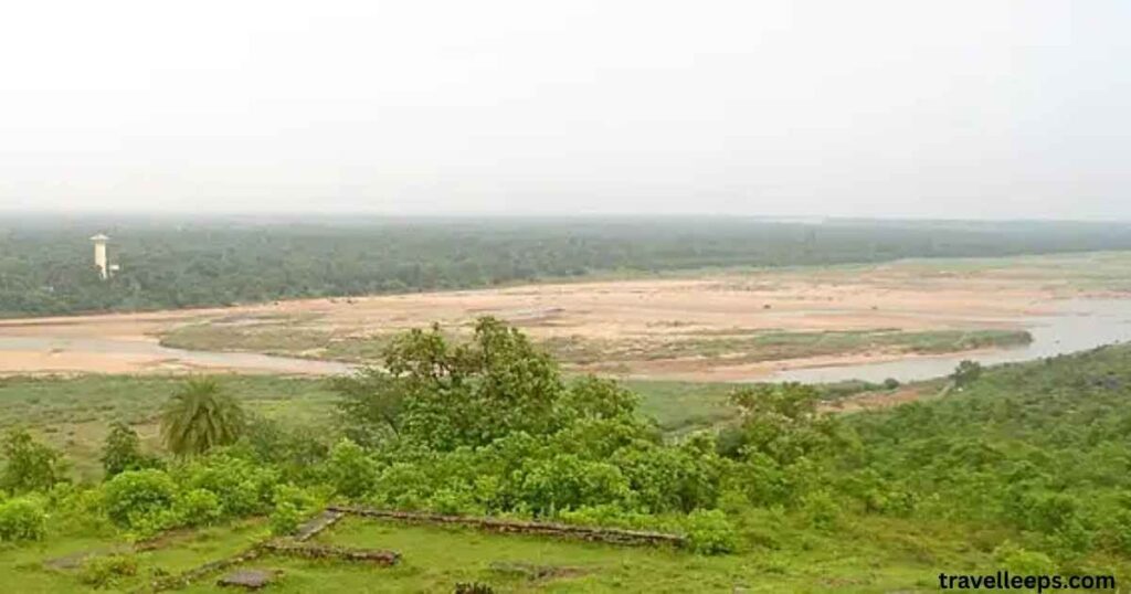
- Receives heavy rainfall during the southwest monsoon
- Seasonal flow patterns with high water discharge during monsoon months
- Plays a key role in flood control and irrigation projects in coastal Andhra Pradesh
This mix of terrain, seasonal flow, and fertile plains makes the Vamsadhara an indispensable resource for both ecology and local communities.
Also know: Shamirpet Lake: The Perfect Escape from Hyderabad’s Hustle
Interstate Aspects
The Vamsadhara River plays a critical role in interstate relations between Odisha and Andhra Pradesh. Here are the key aspects that highlight its shared importance:
States Involved
- Odisha: Source region, with catchment areas in Kalahandi, Rayagada, and Gajapati districts
- Andhra Pradesh: Downstream state, relies on the river for irrigation in Srikakulam district
Water Utilization
- Andhra Pradesh seeks to use more water through projects like the Neredi Barrage and Hiramandalam Reservoir
- Odisha raises concerns about land submergence and displacement of people in upstream areas
- Both states argue over “unutilized water” and how it should be shared
Legal and Institutional Framework
- Governed under the Interstate River Water Disputes Act, 1956
- The Vamsadhara Water Disputes Tribunal was formed in 2009, chaired by Justice Mukundakam Sharma
- Dispute centers on equitable distribution and sustainable usage
These aspects show that the Vamsadhara is more than just a river ,it’s a lifeline that requires cooperation and careful management between two states.
Unutilized water
A major point of debate between Andhra Pradesh and Odisha is the question of unutilized water in the Vamsadhara River. Studies have shown that a significant portion of the river’s annual flow still drains into the Bay of Bengal without being used for irrigation or drinking purposes. Andhra Pradesh argues that tapping this surplus water through projects like the Neredi Barrage and Hiramandalam Reservoir can transform agriculture in its coastal districts.
On the other hand, Odisha is cautious about large-scale diversions, pointing out risks such as land submergence, ecological imbalance, and displacement of local communities. The Vamsadhara Tribunal has been tasked with assessing how much of this unutilized water can be equitably shared without harming upstream regions. Thus, the issue isn’t just about numbers , it’s about finding a balance between development and sustainability for both states.
Major Tributary: Mahendratanaya River
The Mahendratanaya River is the most significant tributary of the Vamsadhara River, rising from the scenic Mahendragiri Hills in the Eastern Ghats. Flowing mainly through Gajapati district in Odisha and Srikakulam district in Andhra Pradesh, it eventually joins the Vamsadhara near Kashinagar. Despite its relatively smaller size, it plays a vital role in supporting agriculture and local water needs in the regions it passes through.
This tributary is also home to several small irrigation projects and check dams that help harness its seasonal flow. During the monsoon, the Mahendratanaya boosts the water levels of the Vamsadhara, making it crucial for farmers downstream. Its ecological and agricultural significance makes it an indispensable link in the river system, ensuring that both states benefit from this shared water resource.
River Water Dispute
The Vamsadhara River dispute highlights the struggle between development and sustainability across two states. Here’s a breakdown of the issue:
Core Issue
- Andhra Pradesh’s stance: Pushes for projects like the Neredi Barrage and Hiramandalam Reservoir to irrigate farmlands in Srikakulam district
- Odisha’s stance: Opposes these projects citing risks of land submergence, displacement, and loss of cultivable land
Legal Actions
- The conflict escalated under the Interstate River Water Disputes Act (1956)
- The Vamsadhara Water Disputes Tribunal was formed in 2009, headed by Justice Mukundakam Sharma
- Tribunal’s task: Decide equitable sharing of water and assess project impacts
Broader Implications
- Reflects recurring interstate water-sharing disputes in India
- Raises questions on sustainable water management and ecological balance
- Highlights the difficulty of aligning state priorities with national frameworks
This dispute shows how a river can become more than a natural resource ,it turns into a stage for politics, law, and survival.
Key Agreements and Developments
The story of the Vamsadhara River is shaped not just by its natural flow but also by the agreements and projects that define how its waters are shared. Over the decades, both Andhra Pradesh and Odisha have signed pacts and taken steps to use the river’s potential while protecting their own interests.
Important Developments
- 1970s: Initial proposals for barrages and irrigation projects were floated by Andhra Pradesh
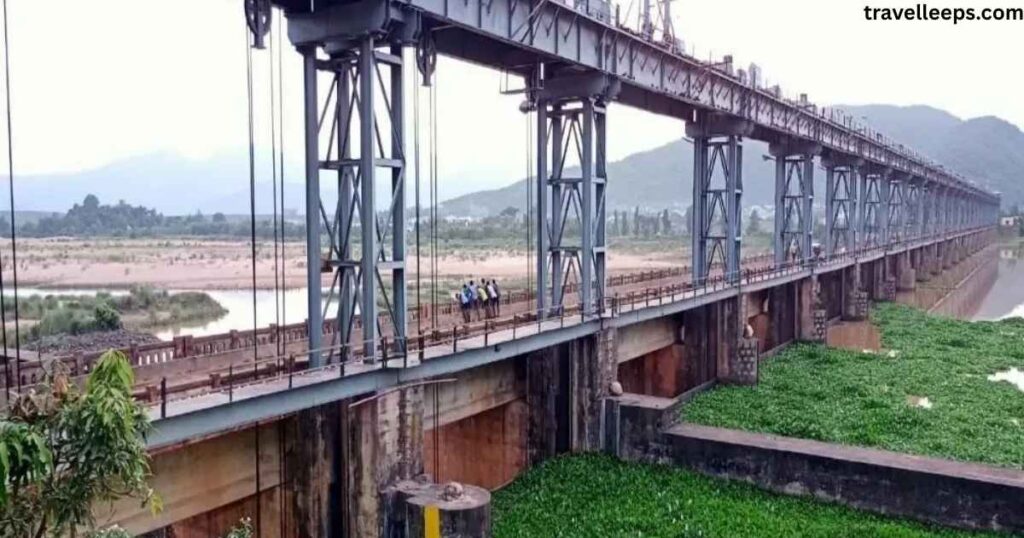
- Gotta Barrage: One of the earliest completed projects, designed for irrigation and flood control in Srikakulam district
- Neredi Barrage Proposal: Strongly supported by Andhra Pradesh, but contested by Odisha due to submergence concerns
- 2009: Formation of the Vamsadhara Water Disputes Tribunal under the Interstate River Water Disputes Act
- Recent Years: Ongoing hearings, technical assessments, and calls for sustainable water-sharing practices
These agreements and developments show that the river isn’t just about water ,it’s also about negotiation, compromise, and long-term planning. Each step taken reflects how states balance immediate needs with future sustainability.
Vamsadhara River Tribunal
To address the ongoing disputes between Andhra Pradesh and Odisha, the central government set up the Vamsadhara River Water Disputes Tribunal in 2009. It was established under the Interstate River Water Disputes Act (1956) and headed by Justice Mukundakam Sharma. The tribunal’s main responsibility is to decide how the river’s waters should be equitably shared and to evaluate the impacts of projects like the Neredi Barrage and Hiramandalam Reservoir.
Key Roles of the Tribunal
- Examine claims from both states about water requirements and availability
- Assess environmental and social impacts of proposed projects
- Ensure compliance with legal frameworks for interstate water management
- Recommend fair distribution of unutilized water without harming upstream or downstream communities
The tribunal continues to play a crucial role, though disputes remain active. Its work highlights how water management is not just a scientific issue but also a deeply legal, social, and political challenge in India.
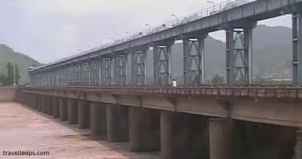
Components of the Vamsadhara Project
The Vamsadhara Project was designed to harness the river’s potential for irrigation, flood control, and water supply. It includes a network of barrages, reservoirs, and canals aimed at supporting agriculture and improving livelihoods, especially in the drought-prone Srikakulam district of Andhra Pradesh.
Major Components
- Gotta Barrage: One of the earliest completed structures, providing irrigation and helping control floods
- Neredi Barrage: Proposed project on the border, facing opposition from Odisha due to submergence concerns
- Hiramandalam Reservoir: Key storage project built to stabilize water supply for agriculture
- Left Main Canal (LMC) & Right Main Canal (RMC): Distribute water from the reservoir to farmlands
- Nagavali Link Canal: Connects the Vamsadhara with the Nagavali River system to optimize water use
Together, these components form the backbone of the river’s development strategy. They show how infrastructure is used to balance water demand, agriculture, and regional growth, though not without legal and ecological challenges.
Hiramandalam reservoir
The Hiramandalam Reservoir is one of the most important components of the Vamsadhara Project, built to improve irrigation and water storage in Andhra Pradesh’s Srikakulam district. Constructed across the Vamsadhara River, the reservoir was planned to stabilize water supply for thousands of acres of farmland, reducing the region’s dependence on erratic monsoon rains.
Key Features
- Acts as a storage reservoir for irrigation in drought-prone areas
- Supports both Left Main Canal (LMC) and Right Main Canal (RMC) networks
- Provides water for agriculture, drinking, and industrial use in nearby regions
- Plays a role in flood control by regulating river flow during heavy rains
The Hiramandalam Reservoir is a lifeline for local farmers, but it also sparked debates over environmental impact, displacement of people, and interstate tensions. Still, it remains central to Andhra Pradesh’s irrigation strategy and showcases how infrastructure can reshape a river’s role in regional development.
Vamsadhara and Nagavali link canal
The Vamsadhara and Nagavali Link Canal was conceived to connect two major east-flowing rivers of north coastal Andhra Pradesh. By linking the Vamsadhara with the Nagavali River system, the project aims to make better use of surplus water and reduce wastage into the Bay of Bengal. This interlinking helps in balancing water distribution across regions that often face uneven rainfall and recurring droughts.
Key Objectives
- Optimize water use by diverting unutilized flows from the Vamsadhara
- Stabilize irrigation in areas dependent on the Nagavali River basin
- Improve agricultural productivity in Srikakulam district and nearby regions
- Contribute to flood control and drought management
The canal represents a forward-looking model of river basin management, though it requires careful ecological and social assessment. It stands as an example of how linking rivers can boost regional resilience while raising important questions about long-term sustainability.
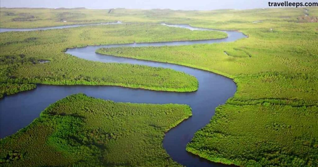
Vamsadhara River Map
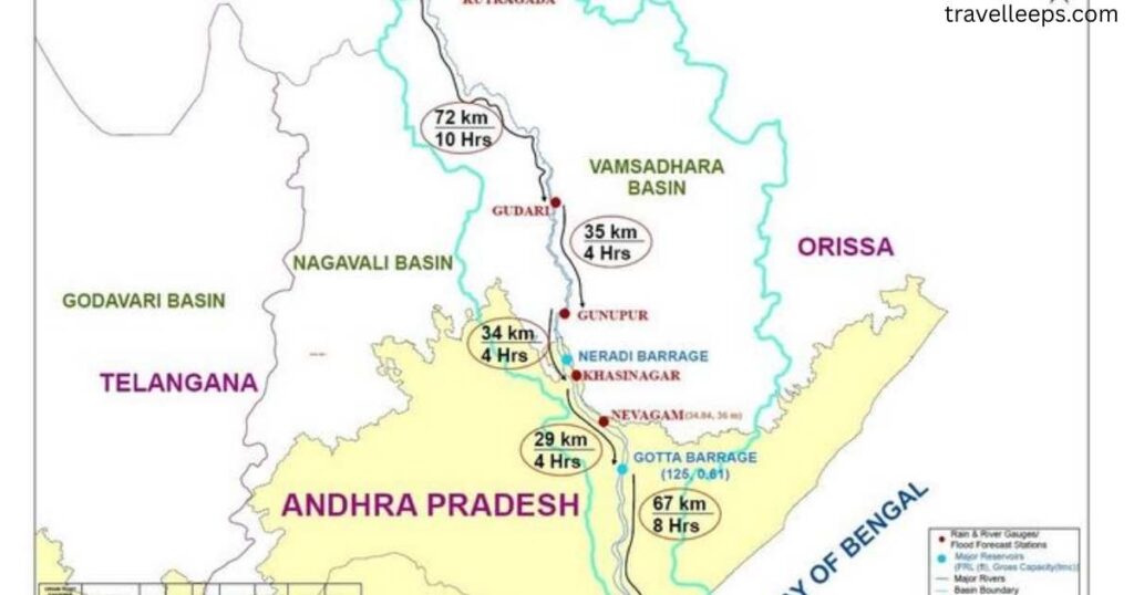
Understanding the Vamsadhara River map is essential to grasp its course, basin area, and significance for both Andhra Pradesh and Odisha. The river originates in the Eastern Ghats near Thuamul Rampur in Kalahandi district (Odisha), flows through Rayagada and Gajapati districts, and then enters Srikakulam district in Andhra Pradesh. Finally, it drains into the Bay of Bengal at Kalingapatnam, making it a classic east-flowing river.
Key Map Highlights
- Total Length: ~254 km
- Basin Area: ~10,830 sq. km shared between Odisha and Andhra Pradesh
- Major Tributary: Mahendratanaya River (joins near Kashinagar)
- Infrastructure on Map: Gotta Barrage, Neredi Barrage (proposed), Hiramandalam Reservoir
- Nearby Landmarks: Kalingapatnam Beach, Mahendragiri Hills, Srikurmam Temple
A map of the river not only shows its geographical journey but also highlights the regions dependent on it. For students, travelers, or researchers, the Vamsadhara map provides context to the river’s ecological, cultural, and economic importance.
Nearby Attractions to Vamsadhara River
The Vamsadhara River isn’t just about irrigation projects and water disputes ,it also flows through regions rich in culture, history, and natural beauty. Travelers exploring its course can discover a mix of beaches, temples, and hill ranges that bring the landscape to life. These spots make the river basin an attractive destination for those who enjoy blending nature with heritage.
Popular Attractions
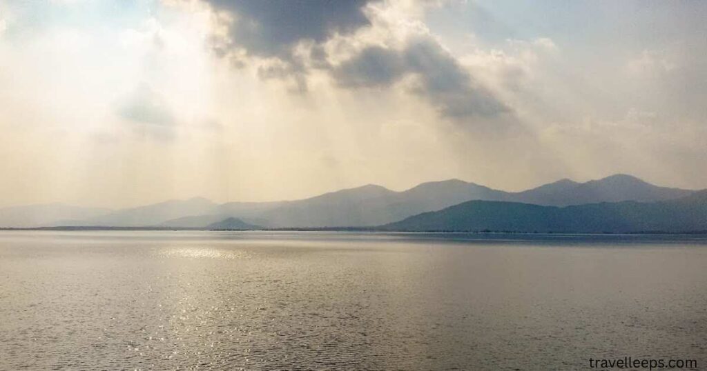
- Kalingapatnam Beach – Where the Vamsadhara meets the Bay of Bengal, offering calm waters and stunning sunsets
- Mahendragiri Hills – A lush range in the Eastern Ghats, tied to legends from the Ramayana and Mahabharata
- Srikurmam Temple – A rare shrine dedicated to Lord Vishnu in the form of a tortoise, located near Srikakulam
- Mukhalingam – Known as the “Varanasi of the South,” this temple town showcases beautiful Kalinga architecture
- Kaviti Beach – A serene and less crowded coastal spot, ideal for quiet getaways
These attractions make the Vamsadhara basin more than just a river system ,it’s a blend of spirituality, history, and scenic escapes that reflect the cultural richness of Andhra Pradesh and Odisha.
FAQ’s
What is the origin of the Vamsadhara River?
The Vamsadhara River originates in the Eastern Ghats, Thuamul Rampur, Kalahandi district, Odisha, at about 1,200 meters elevation.
Which districts does the Vamsadhara River flow through?
It flows through Odisha’s Kalahandi, Rayagada, Gajapati, and Andhra Pradesh’s Srikakulam district before joining the Bay of Bengal.
What is the length of the Vamsadhara River?
The Vamsadhara River stretches about 254 kilometers, flowing from Odisha through Andhra Pradesh before meeting the Bay of Bengal.
What is the main tributary of the Vamsadhara River?
The Mahendratanaya River, originating from Mahendragiri Hills, is the major tributary of the Vamsadhara, joining near Kashinagar.
Why is the Vamsadhara River disputed?
Disputes arise between Andhra Pradesh and Odisha over water utilization, barrages, and reservoirs, leading to tribunal intervention for settlement.
Conclusion
The Vamsadhara River may not be as widely known as the Ganga or Godavari, but for Andhra Pradesh and Odisha, it’s nothing short of a lifeline. From its origin in the Eastern Ghats to its confluence with the Bay of Bengal, the river shapes agriculture, supports biodiversity, and sustains millions of people.
At the same time, it carries the weight of disputes, development projects, and ecological concerns that reflect India’s broader water challenges. Finding harmony between progress and preservation will decide how future generations experience this river. In the end, the Vamsadhara isn’t just a watercourse ,it’s a reminder that rivers are threads weaving together culture, economy, and survival.

With over five years of experience in crafting engaging and insightful content, I’m the creator of TravelLeeps.com; a travel blog dedicated to inspiring journeys, practical tips, and unforgettable destinations around the globe.